Create a Collection - Part 7 - Walkthrough of GeoConcerns
Jun 7, 2016
This is part of a larger tutorial created and presented as "Walkthrough of GeoConcerns".
Create a collection
- What is a collection?
- Make a collection
- Add items to the collection
What is a collection?
"Anything you want it to be."
- Jon Stroop
In Hydra/PCDM, a collection is an arbitrary grouping of resources to use how you see fit. In the previous steps, we created an image work for a scanned map and a child raster work for a georectified version of that map. Perhaps we are just starting the process of digitizing and preserving a set of related maps. We can use a collection to group these objects together.
Make a collection
- Click the + symbol in the upper-right corner.
-
Select Add a Collection from the drop-down menu.

-
Fill out fields on the Create New Collection form. Only the Title field is required.

- Click the Create Collection button at the bottom of the page.
- You’ve now created your first collection!
Add items to the collection
- On the Collection show page, click Add file from your dashboard
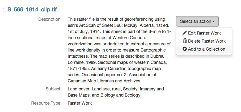
- Find the Select an action button next to your raster work.
-
Select Add to a Collection

-
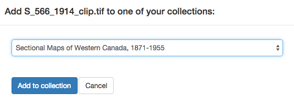
Select your new collection from the drop-down menu on the dialog box.

-
The raster work is now part of the collection.

- Click on the Raster Work title to go to it’s show page and then head over to the next section.
- Introduction
- Part 1 - Setting up your environment
- Part 2 - Create your application
- Part 3 - Starting the application
- Part 4 - Create an image work
- Part 5 - Add files to the image work
- Part 6 - Create a raster work
- Part 7 - Create a collection
- Part 8 - Create a vector work
- Part 9 - Viewing derivatives

